The Colorado Public Lands Collaborative consists of a variety of organizations who give their unique perspectives on issues related to public lands (federal, state, county, and municipal) across Colorado.
COUNTY CHAPTERS:
Boulder County Public Lands Collaborative
MEDIA & EVENTS
50 Locals Hike Through a “Thinned” & Burned Forest
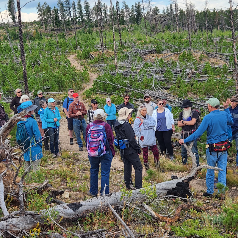
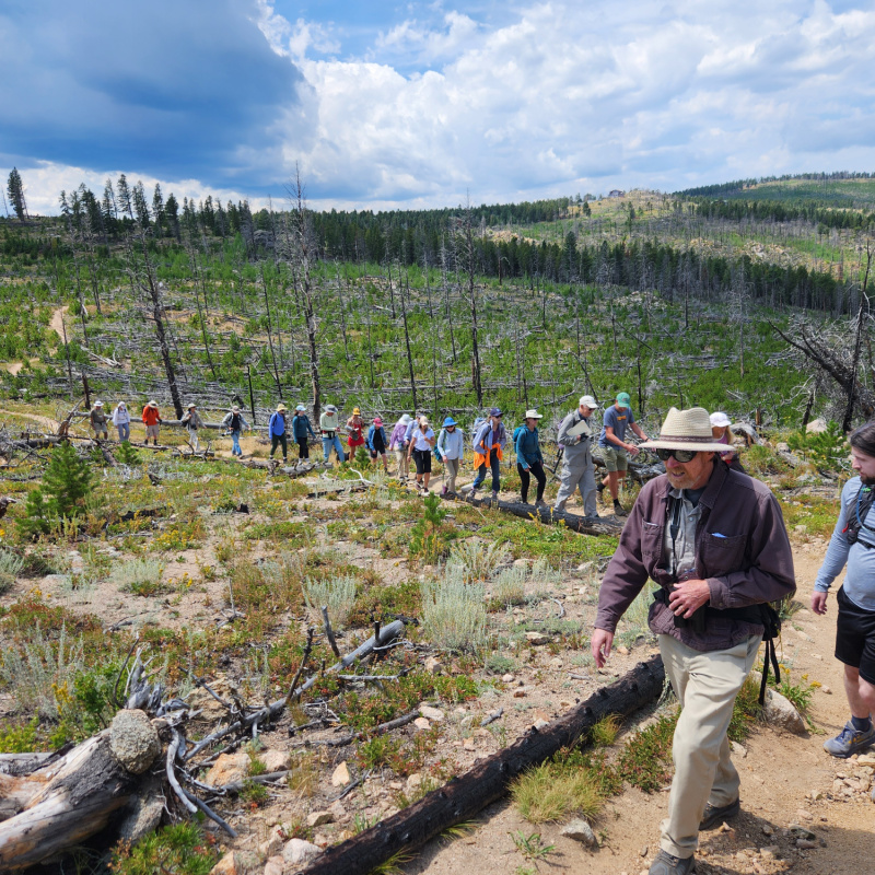
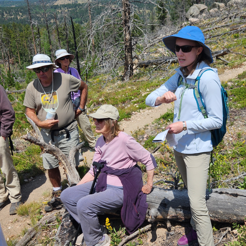
On August 10 and August 24, Boulder County Public Lands Collaborative held guided hikes for over 50 locals through a section of the Roosevelt National Forest (just outside Nederland, Colorado) “thinned” for “fuel reduction” in 2015. This cut patch of forest burned at mostly high-severity in the 2016 Cold Springs fire, while the adjacent uncut forest did not burn at all.
Guides included Teagen Blakey and Alex Markevich with Magnolia Forest Group, Dave Hallock with Earthwork Conservation Planning, and Josh Schlossberg with Eco-Integrity Alliance. Special guest was Dr. Thomas Veblen, retired Distinguished Professor Emeritus at CU Boulder and one of the world’s leading experts on wildfire ecology in the Front Range with nearly 500 published peer reviewed studies.
The hike began in a section of the Roosevelt National Forest where both small and large-diameter trees had been cut by the U.S. Forest Service in 2015 for a wildfire “fuel reduction” project. Guides pointed out blackened stumps charred during the 2016 Cold Springs fire.

With a ridgeline view of much of the Cold Springs burn area, guides relayed the history of the origin of the blaze as an escaped campfire, pointing out areas where it had been fought and where it had been left to burn. Some helpful new information was provided by locals living in the area.
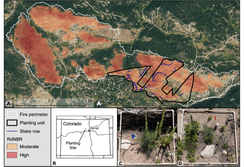
Hikers were then led to the edge of the “thinned” area of National Forest to an acreage of dense, mature private forest that hadn’t been cut. It was clear that while the fire had burned at mostly high-severity in the cut area, it hadn’t burned at all in the uncut forest. This evidence was corroborated with a figure from a study conducted by U.S. Forest Service in 2023.
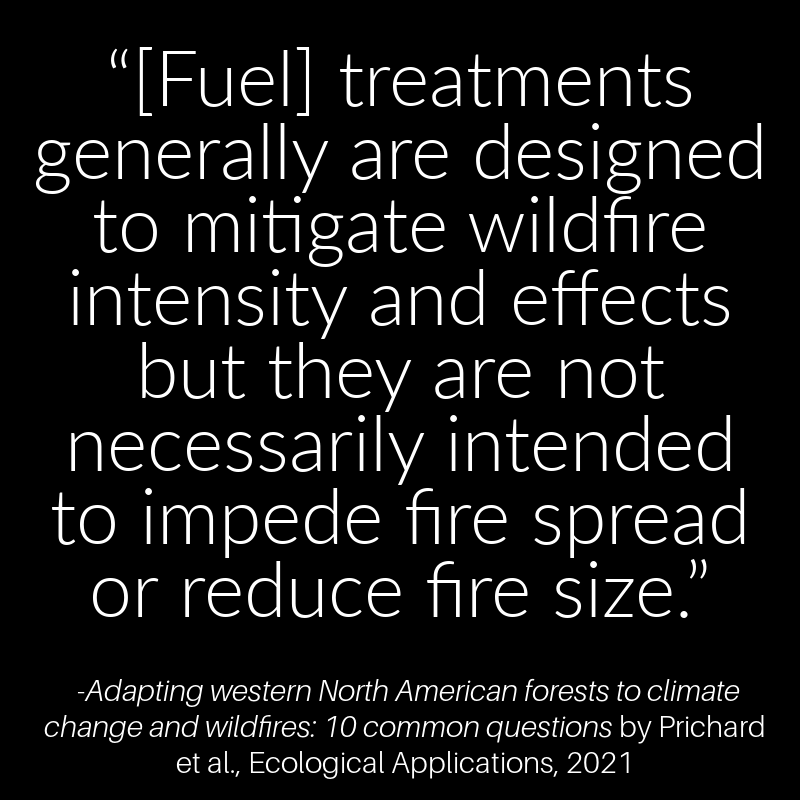
Hike guides presented a full spectrum of peer-reviewed wildfire-forest science. This included studies showing that “thinning” might sometimes reduce the burn severity of low- and moderate-intensity wildfire yet rarely influence weather and wind-driven high-intensity fires which are the main threat to communities.
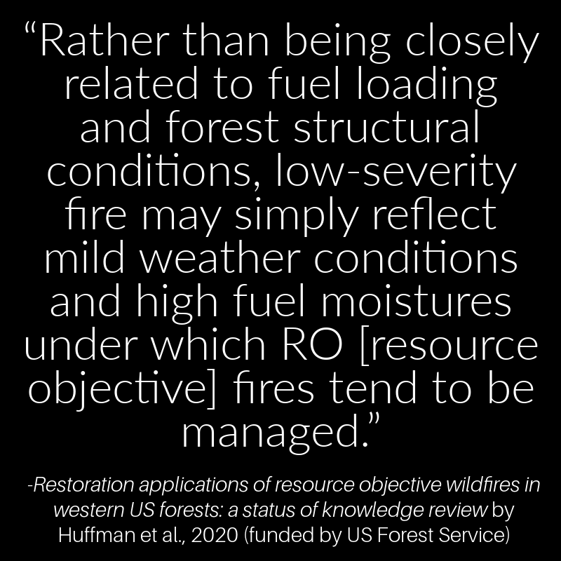
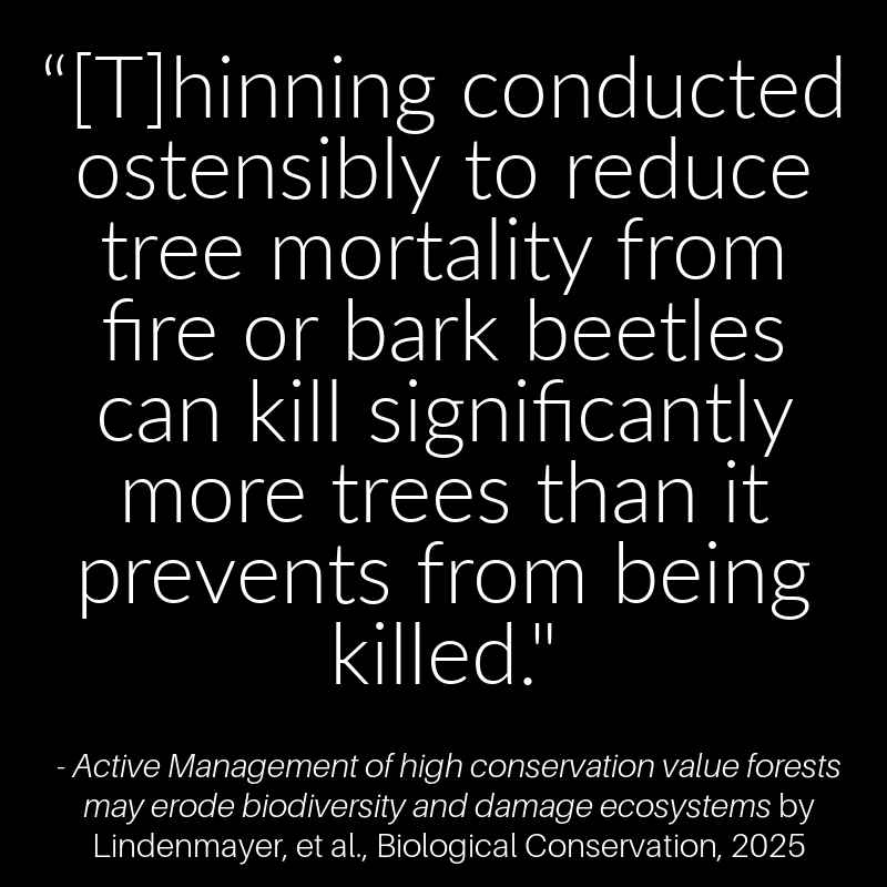
Guides also shared studies differentiating between an attempt to reduce fire severity in the forest—a questionable aim in that many ecosystems and wildlife are dependent on such fires and “thinning” often kills more trees than fire—and the goal of preventing flames from spreading to communities.

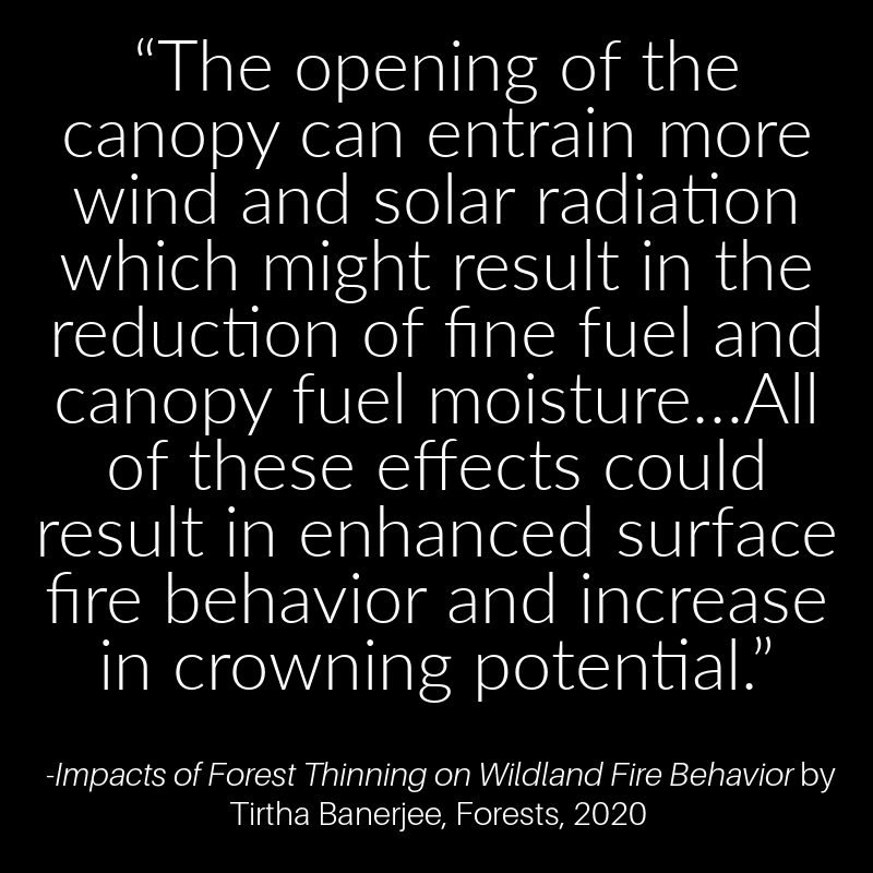
Other studies demonstrated how tree removal can make the forest microclimate hotter and dryer and therefore more likely to ignite and exacerbate a fire—including crown fires—and allow winds to spread flames to communities.
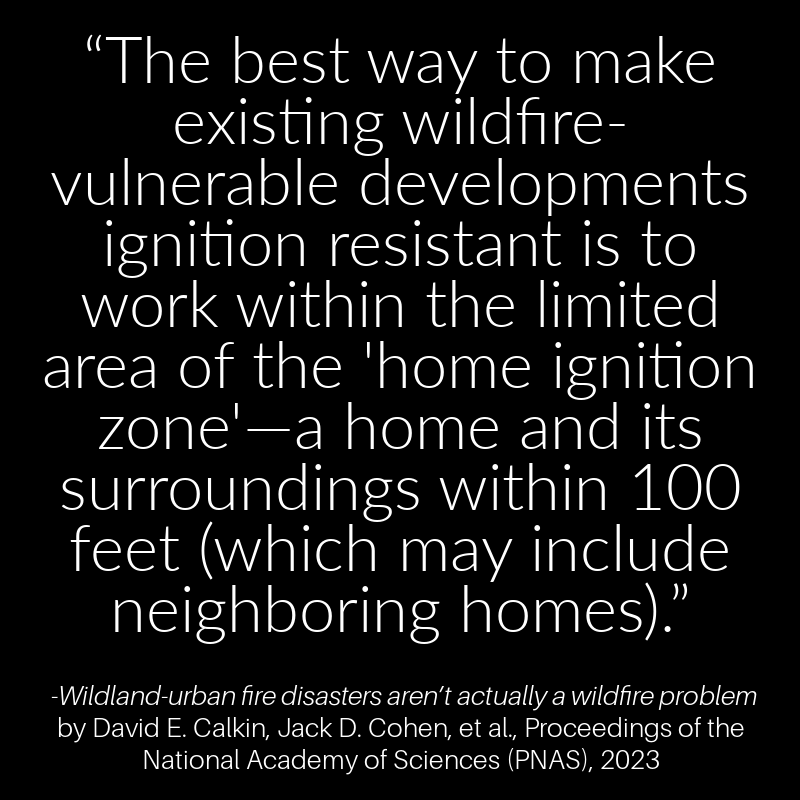
Other studies were cited pointing out how the scientific consensus for protecting communities from wildfire is home hardening and defensible space pruning up to 100 feet around homes.
Along the way, hikers were asked to note the varying degrees of tree regeneration from replanting the U.S. Forest Service carried out in 2018 in the “thinned” and burned area. As shown in the 2023 study, regrowth from the planting was more abundant on north facing slopes and shaded areas where trees hadn’t been cut. Equally or even more abundant growth was visible in sections of the burn that hadn’t been “thinned” and therefore didn’t need replanting.
At the end of the walk, hikers were asked to consider whether they believed the burden of proof had been met for such “fuel reduction” currently proposed for potentially hundreds of millions of acres of federal, state, county, and municipal public land forests.